
A few years ago, I walked the West Highland Way, Scotland’s best-known and most popular long distance walking path. Since then, I’ve completed many long day walks but nothing of comparable scale. One of the issues with other long-distance paths in Scotland is that there aren’t the same facilities for walkers at the end of each stage comparable to the West Highland Way. With far fewer foot traffic on these routes services like baggage transfer is either expensive or non-existent.
Coming out of lockdown I had been bitten by the bug to get out and do a long walk again but this time I’d be carrying everything with me. A big ask for someone who didn’t feel particularly fit.
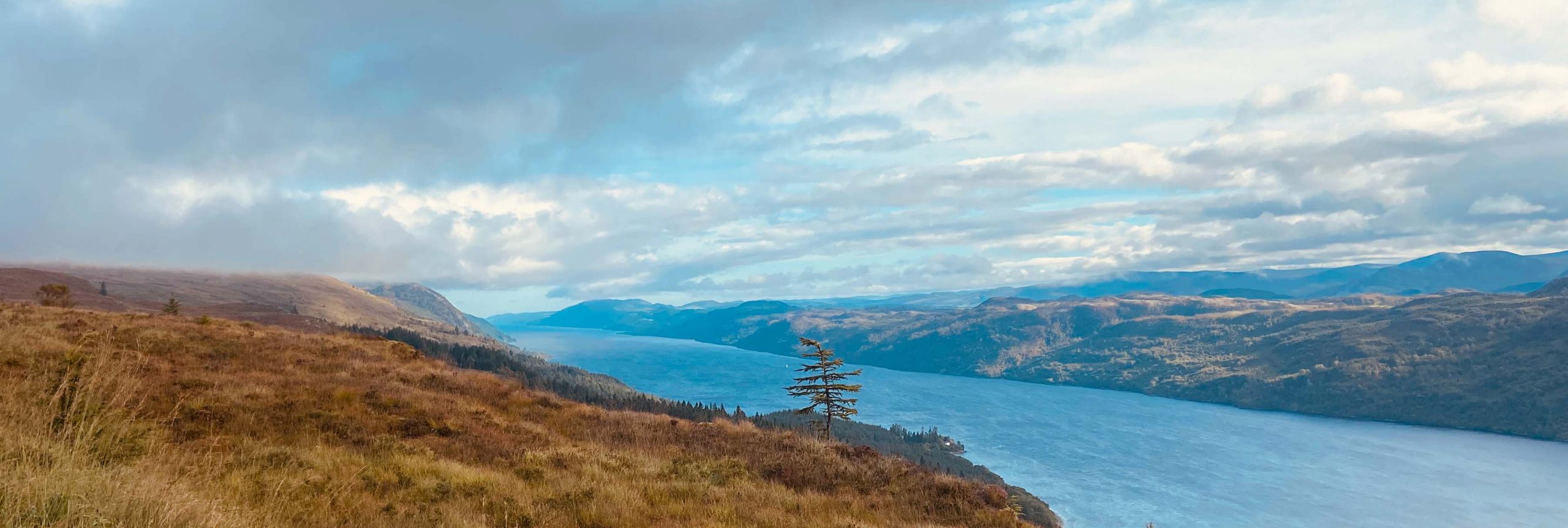
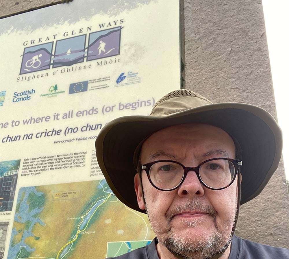
After weighing up a few options I decided on the Great Glen Way; 78 miles of paths from Fort William to Inverness following what’s known as ‘The Great Glen’ the long string of lochs and canals that run North-East along a natural fault line. After lots of long practice walks and fine tuning my pack weight down to a sensible (but still heavy) 30 pounds (about 13.5 Kilos) in weight it was time to set off.
The journey from Edinburgh to Fort William involved a train to Glasgow and a connecting train from there. The trip by train is an experience; Two locomotives are joined together for the route and are separated at Crianlarich station where half the train heads to Oban and the other to Fort William. Despite the train staff making numerous announcements on the way there were still a few individuals having to make a hasty swap of trains when it decoupled! As we trundled on north, we passed stretches of the West Highland Way and I felt the wave of nostalgia watching hikers wend their way to what would be my start point. The train also takes a slightly different route from the road, passing along the East side of Rannoch moor – it was really interesting experiencing a part of Scotland I had never seen before.
Day 0:
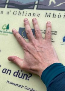
Not quite day one but since the campsite I’d chosen to spend the first night before setting off properly was a small detour a little way along the Great Glen way it made sense to actually chalk off the first small part of the route to save me doing it in the morning. From the train station it was a few minutes’ walk over a few roundabouts to get to the ruins of the old fort that Fort William gets its name from – this is the official start of the Great Glen Way. I placed my hand on the stone turned about and set off.
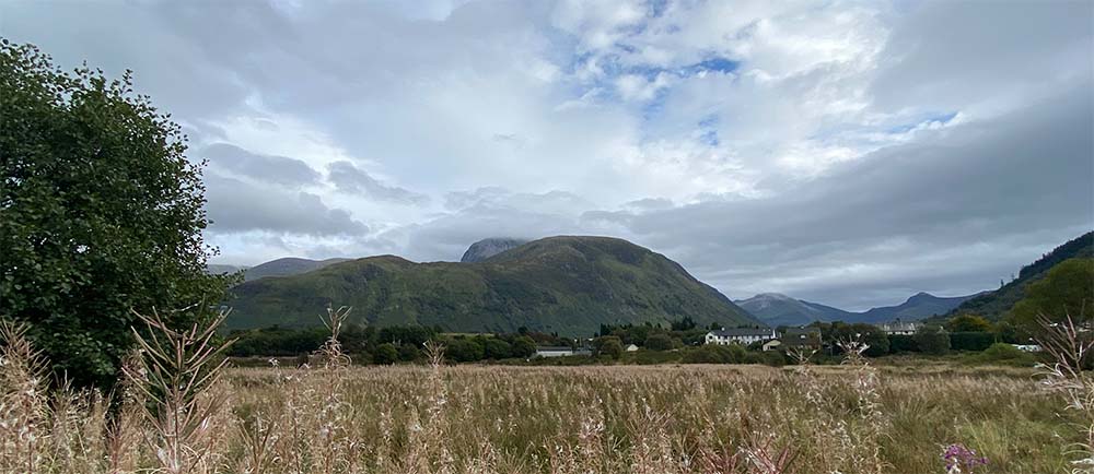
It was a clear dry evening and a pleasant enough walk out of Fort William’s centre, along a small footpath that ran alongside a field where on the other side billows of smoke blew from the Mallaig Steam train and Ben Nevis loomed in the background. Very soon I reached a long footbridge known as the Soldier’s Bridge and from there I had to leave the route and make my way through the outskirts to a rather large holiday park that offered camping. With my tent quickly pitched I settled in for the evening, I had intended to explore a little but by then it was already getting dark so decided to get an early night.
Day 1: Fort William to Gairlochy.
The first night in a tent for a long time was naturally an uncomfortable one, After a fitful sleep I decided to get up and have breakfast. There had been a fair amount of rain overnight and this first day wasn’t looking too great – not the best of starts and after swapping into rain gear I packed up and set off. The weather was humid with fine drizzle and the walking for this first stage is uninspiring, passing from Fort William almost immediately into the village of Caol, more of a large satellite estate to the main town really. At one point I trudged past a set of roadworks and a cheery workman felt obliged to remind me I had 78 miles to go ‘76’ I retorted – I’ve already walked 2. At Caol I was tempted into a small community run café that had just opened for the day so took the opportunity for a coffee and snack. With all this extra weight and my concerns of fitness I had decided to take every opportunity for a break on the way.
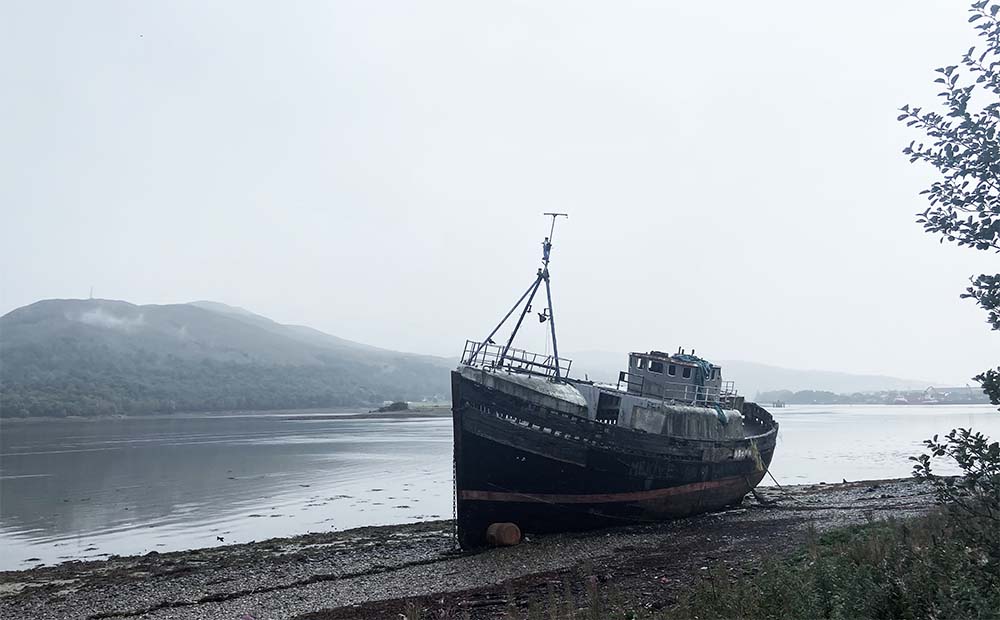
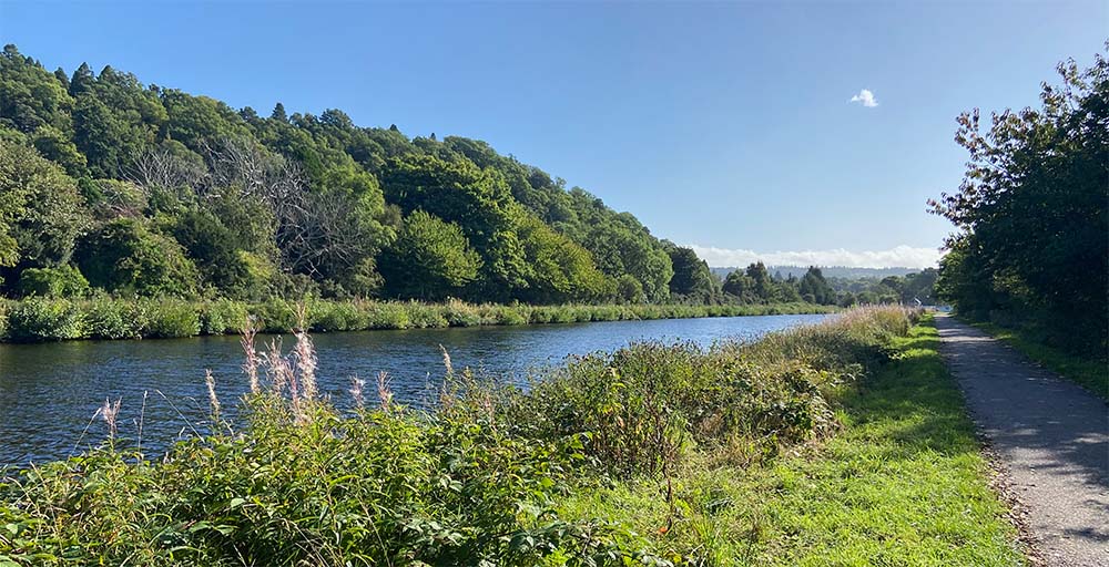
On leaving Caol the route took me along the shore of Loch Linnhe, passing an impressive and well photographed shipwreck before climbing up to reach the start of the Caledonian Canal at Corpach. The Caledonian Canal links the various lochs along the way providing a safe sea link between the North sea and West coast of Scotland, once a busy commercial route its almost entirely used for leisure now; yachts, motorboats, kayaks etc. After a quick wander round by the sea lock at Corpach I headed along the first canal stretch.
In order to obtain enough height to match the level of Loch Lochy, the first loch on the route there are several sets of Locks and the first of these comes up almost immediately. Neptunes Staircase, an impressive set of 8 locks that run for 180 feet along the canal and allow it to rise by 64. This is the longest staircase lock in Britain. While it takes a boat 90 minutes to pass through the lock system it took me far less – even with my huge pack. After leaving Neptunes staircase the route follows the canal towpath – naturally very flat and relatively straight. The River Lochy runs alongside this stretch of canal and you catch a glimpse of it now and again to your right – its only when you see the river far below that you appreciate what a feat of engineering the canal really is – carefully hugging the contour of the hills with a steep bank built up from the edge of the river below.
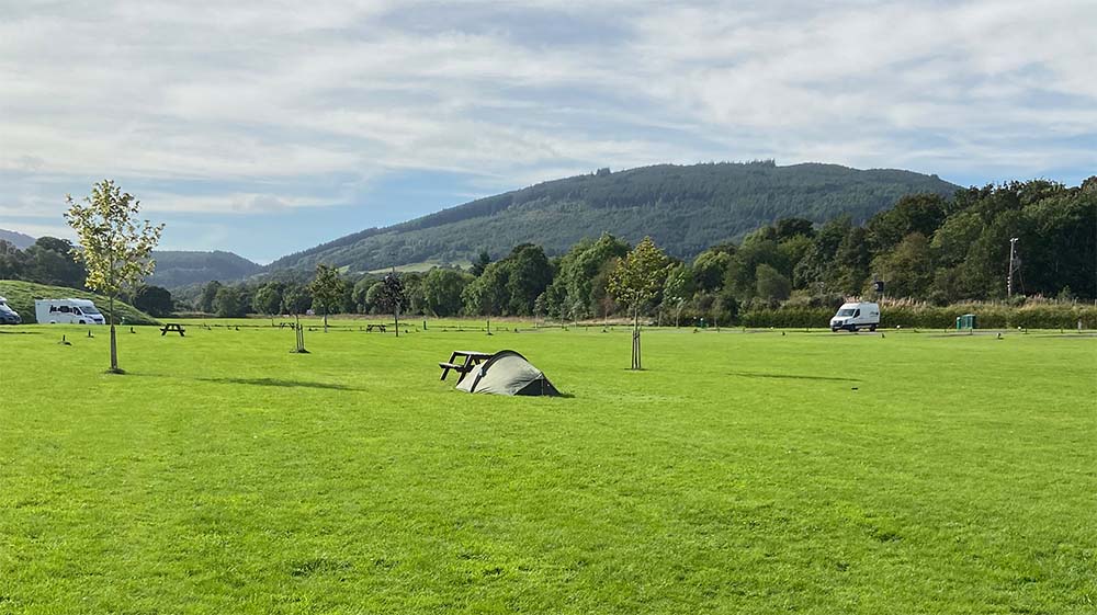
While I appreciated the gentle walk to ease into the route the canal stretches do seem to go on forever and you welcome any break, any swing bridge or piece of canal architecture becomes fascinating and worthy of a stop and rest. Eventually I reached the small settlement of Gairlochy where I left the route on the minor road that initially wound down and then steeply up for a very long time to finally reach the campsite on the Spean Bridge Road. The tent area was small and felt very exposed to site traffic – it also got very wet and with little else to do I cowered from the rain in my small tent trying to kill time till dark. My second night under canvas.
Day 2: Gairlochy to Laggan.
The forecast for the day had been clear with sunny intervals but that wasn’t evident on opening my tent and seeing yet more drizzle! I packed and set off as quickly as my stiff limbs would allow but after a few hundred yards the skies opened, and I had to quickly take shelter and get into waterproof gear. It seemed even longer getting back to the start point than yesterday but once there I was able to continue. This stage runs along the north-west shore of Loch Lochy and begins with a less than exciting minor road that climbs up before entering a small patch of forest then crossing the road again to run along the lochside. This stretch was far more scenic, and I passed several perfect little wild camping spots that I wish I’d known about. Soon the sun came out and I was able to strip down a bit and take a break to absorb the views. This was one of the nicest stretches of the day and a welcome change from the canal-side walk of yesterday. Before long the path led up to a small road, this led through the Achnacarry area, The Clan Cameron Museum was a 1km detour up a long drive but while I was still adjusting to the weight I was carrying I decided to leave it for another day.
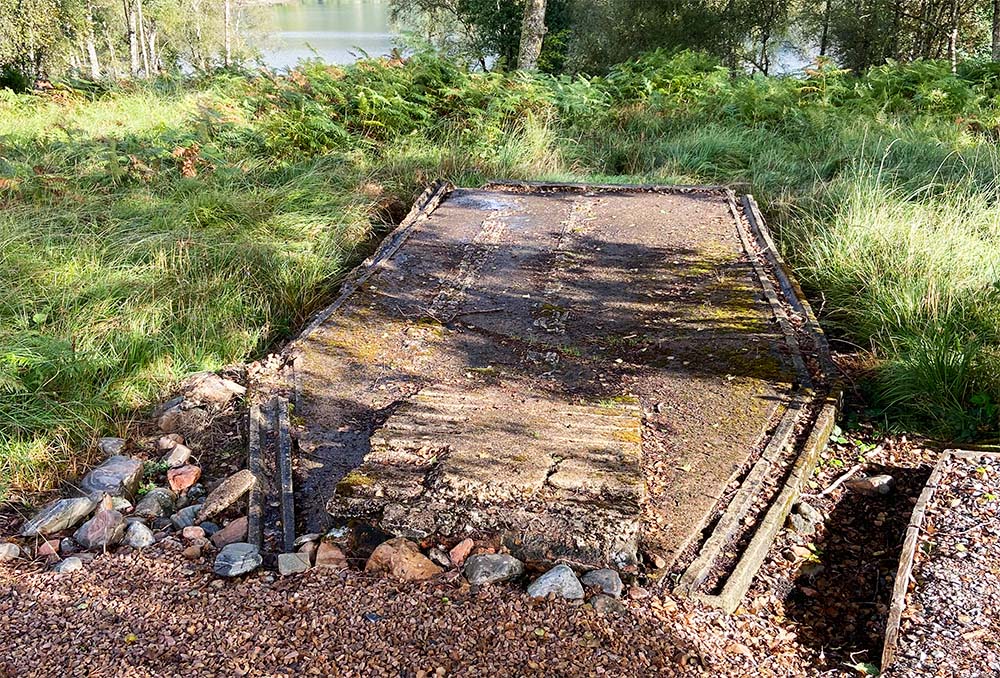
Quite unexpectedly I came across the first of a series of sites that mark the time spent by British Commandos training in this area during WWII. There is a well-known monument to the Commando regiments a few miles away at Spean Bridge, overlooking this valley. I had often visited the monument as a stopping point travelling with my father and he had told me that he had been in this area for a time training for the Normandy assaults on D-Day. The first artefact you meet on this route is the outline of a dummy ‘LCA’ (Landing Craft ’Assault’). This was used for practice landings. There was a good chance he would have leapt on and off this thing many times as a young recruit, jumping from the ramp into a ditch filled with water – often with live rounds being fired just over his head. I had a very deep personal moment reflecting on this as I stood on what remains of the old craft that never sailed. I felt connected to another part of his past and wondered what that 18 year old would have thought of me, shuffling along this route.
As the road wound along the shore there were many other interpretive boards explaining the significance of certain training areas and this was welcome company until eventually I had to leave the tarmac and enter the forest tracks again. From here the track wound up and down through dense mixed forest before turning into more uniform commercial planting. These were the sections of my previous adventure on the West Highland Way I had enjoyed least, it was almost impossible to get any sense of where you were and with nothing but a ribbon of sky above and dense spruce trees either side you could be in any forest. The path also seemed to be a permanent upward slope so I was really feeling the pack and my feet were beginning to complain.
When you drive up the A82, the main road between start and end of this trail you seem to pass Loch Lochy in a few minutes. I wasn’t prepared for just how long it would feel to walk. Every time I caught a view through a gap in the trees the head of the loch seemed further away and checking my GPS position was just disheartening. It was then a welcoming sight, not long after a bridge with a rather odd memorial plaque to clear the forest and catch a view of the head of the loch and the canal entrance. It was still some way away though, so I had a long downhill walk, through farmland before reaching the canal and the joy of finding The Eagle Barge (a pub and restaurant on the canal) open. Beer and food were put away and I had the chance to chat to another walker; a young Spanish lad and compare notes on stops and thoughts so far. From there it was a very short woodland walk and an even shorter and faster scurry along the busy A82 to reach the Hostel I’d booked for the night.
Day 3: Laggan to Fort Augustus.
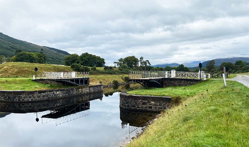
I had hoped that with a bed in a hostel for the night a better sleep would be achieved but sadly no – the hostel bunk beds were metal framed contraptions with chain link bases that had sagged through years of heavy occupancy so the bed felt more like a hammock – on the plus side this very large hostel was also very quiet so I had the 8-bed dorm to myself. After a coffee and a light breakfast I set off again. The route very quickly came to the swing bridge at Laggan. I’ve driven over this more times than i can recall and have never been stopped while the bridge has actually ‘swung’ to allow a boat to pass through so it was quite exciting to see the warning lights flash and barrier come down as the bridge prepared to open.
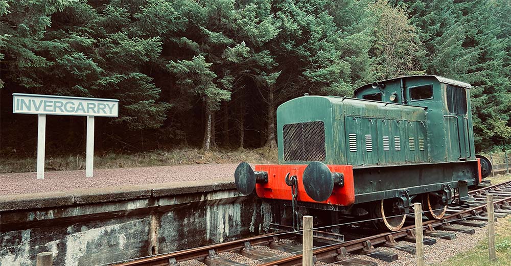
I spent a while watching the bridge do its thing and a pleasure yacht pass through then turned back onto the path – if bridge excitement wasn’t enough almost immediately the path takes you next to Invergarry Station, the only preserved station on what was the Invergarry to Fort Augustus Railway, long since disused the railway line along Loch Oich is now this stage of the Great Glen Way but a small part of track and very cute steam engine has been preserved by a local trust.
Before the railway existed though this long straight track alongside the loch was part of General Wade’s roads, built after the first Jacobite rebellion in order to move troops in quickly to put down any more uprisings, of course the problem with roads is that your enemies can use them just as well as you so they were a curse as much as a blessing to the government. The path is deeply wooded opposite the loch with steep sides and regular warnings of rock falls. I wondered what it might have been like for some young recruit marching up to Fort Augustus anticipating a highland charge through the trees at any minute. On the West Highland Way too, some parts of the route follow one of these military networks. How nice that now they have a less ‘authoritarian’ purpose. To paraphrase Monty Python’s Life of Brian; “what have the Hanoverians ever done for us?” …. “well, there’s the roads.
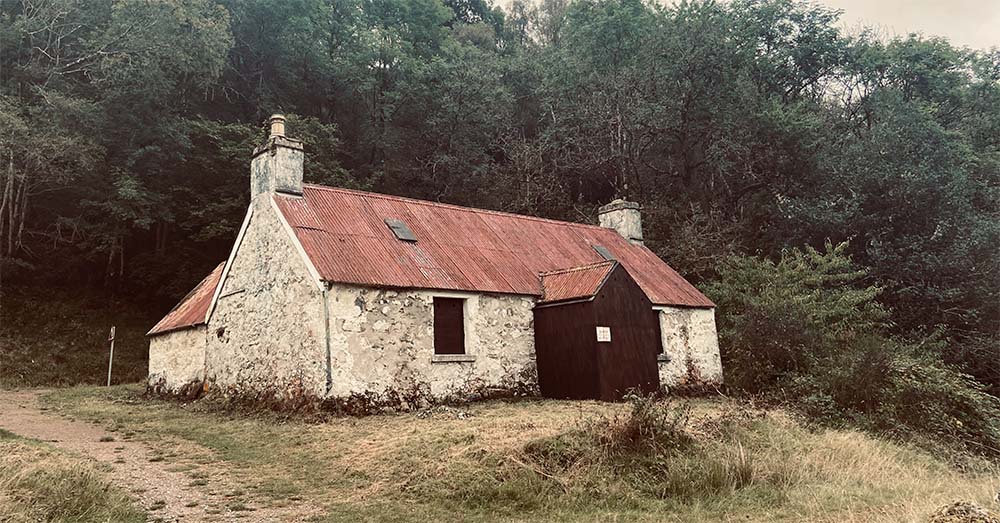
Although very straight and level this is a pleasant section to walk as there’s lots of interest on the loch shore; ruined castles, sunken boats, old bothies and the odd tunnel. No sooner have you become acquainted with Loch Oich though than its time to leave it behind. At the small settlement of Abercalder down the canal there is another swing bridge then a little further on a lock with pretty cottage. As I was passing a small boat was coming through so I paused to watch the lock keeper do his thing – it’s a task that is conducted at a sedate pace and on a day like today it didn’t seem like the worst job in the world.
Beyond this the canal rolled on for a few miles with a pleasant gravel track and another set of locks with the obligatory picture postcard cottage. I had intended to wild camp here but had changed my mind – this was fortuitous as it looked like the wild camping area was being refurbished. From here the waterway widened out so it felt more like a wide lazy river rather than a canal at all. It was busy on the water in this section with a string of canoeists in open Canadian style canoes and several pleasure boats: there’s a lucrative business in hire boats on the great glen, a wonderful (if a little expensive) idea for a lazy week in the highlands.
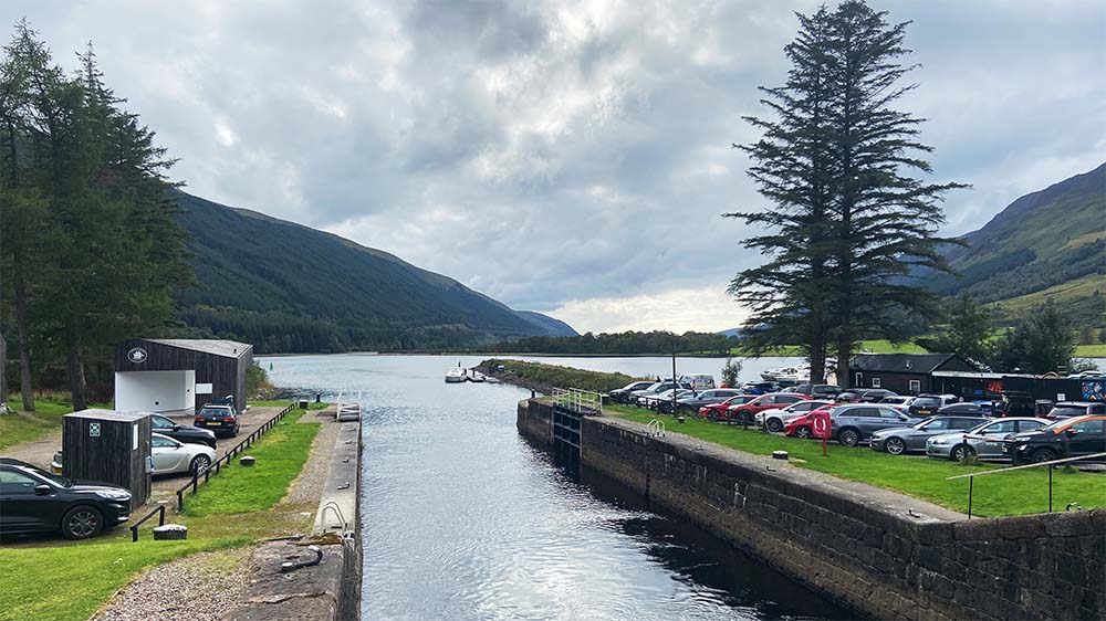
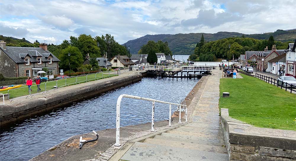
Eventually the houses at the edge of Fort Augustus were reached and beyond the top set of locks on the canal that are the biggest tourist draw for the area. The town was renamed after the Jacobite uprising to ‘Fort Augustus’ after ‘Prince William Augustus, Duke of Cumberland’, known less affectionately perhaps as ‘Butcher Cumberland’ he was the architect of the brutal reprisals after the defeat at Culloden. The pretty staircase of locks are a very popular visitor attraction and the area was naturally busy, this was the most people I’d seen since leaving Fort William so it did feel a little odd. Thankfully the British Legion pub halfway up the lock system was very quiet, so I snuck in for a post-walk pint and then popped next door for takeaway fish and chips. It was a lovely day and with nothing really to do and with time to kill before I could check into the Hostel, I found a grassy spot by the river opposite where the Loch Ness cruise boats departed and had a brief snooze.
As I stuck my shoes back on and got ready to head to the hostel a sudden and quite enthusiastic rain shower decided to dump its contents on the village, I was in no mood to rush and thinking id be in and dry in a few minutes anyway made my way through the rain and the rushing tourists to Morag’s Hostel
Morag’s Hostel was a last-minute decision and all I was able to get there was a private room. It seemed very cheap at £40 for the night so had no idea what to expect. Any concerns I had were soon washed away faster than the tourists had been earlier. The Hostel was by a very long way the best I’d ever stayed in. The room was quirky but perfect (I was in the ‘Unicorn’ room with appropriate décor theme). There was free tea and coffee and a really nicely set-up bar. After a quick freshen up the rest of the evening was spent there having a great chat with the other residents, many on their own, personal but very different journeys – one young man who was from Lithuania was on a solo bike tour and celebrating his 40th birthday that day so this was celebrated with the consumption of a good amount of whisky.
Day 4: Fort Augustus to Invermoriston (and a little beyond)
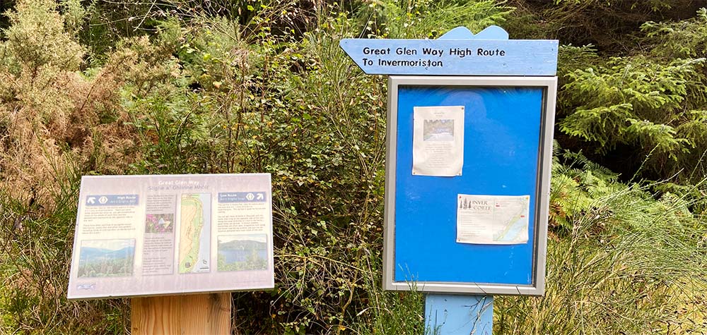
After an excellent sleep and a surprisingly clear head, I took advantage of the Hostel’s light breakfast and left the hostel. Another great advantage of this accommodation was that the Great Glen Way ran right by its entrance, so no detour was required. After a little road walking the track entered the forest again. It was a perfect clear morning and I had the occasional glimpse of red squirrels in the trees ahead. The forest here was open, mature and quite natural so an absolute joy to walk through. That sense of joy got a severe testing very soon though as the path began its steep zig-zagging ascent onto the high-route: There are both high and low route options here but with work being carried out by the local water board on the low route the high road was the only option.
It was getting warm as I climbed slowly but steadily up through the trees. I must have burned through half my daily water supply on this small stretch. Gradually though, the trees began to thin out and I found myself clear and into open moorland with a far less steep gradient. Once up and clear of the treetops the views up and down the length of the glen were absolutely incredible. If ever the phrase ‘worth the effort’ was appropriate…
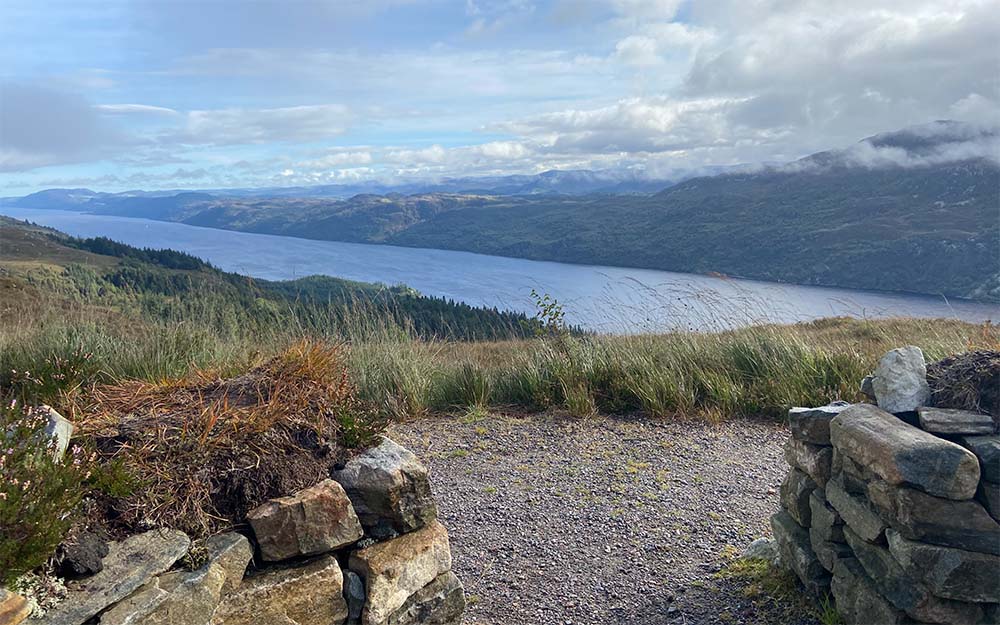
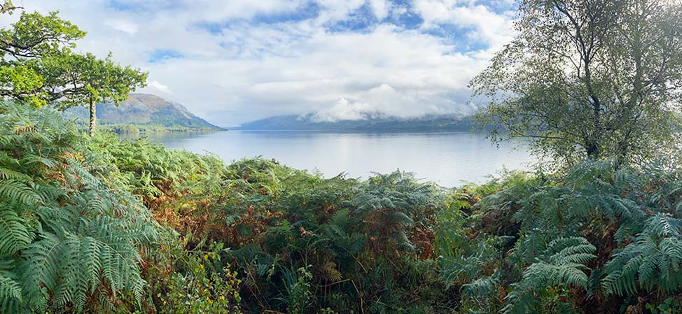
Looking right I could see all the way down to Loch Lochy and beyond and to my left I could make out the mountain ranges near the top end of Loch Ness. The loch itself stretched like a silvery blue ribbon, demanding attention. After a few minutes’ walk a small stone-built shelter was reached and I took a nice long break just soaking up this fantastic view. I honestly could have spent hours here but there was still a long way to go, the next few miles were up and down along a high moorland track with fantastic views all the way. Several large boulders were dotted along the track, perfect for a little rest stop. Eventually though I could see I was coming around the side into Glen Moriston and the track began to descend into the forest again, the descent here was very steep and quite challenging underfoot, knees and feet were complaining and the descent took longer than going up. The path then joined the low route and meandered off into the glen at a less breakneck angle before twisting back towards Invermoriston. I had a quick check online to see what was open and there was a small takeaway café open that day
Invermoriston is another place you tend to zoom through – the A82, runs through here and there is a turn off towards Skye. This is a bit of a shame, there’s lots to explore around the old bridge, a large picnic site and a very nice café selling home baking. Although technically the end of the stage I had mentally treated this as the mid-point of the day, even though there were around 4 miles to go I knew it would feel a lot longer. After a break to let my feet get some air I set off again – the next hour was a long and very steep climb up a minor road that very soon took me back up to the same height I had reached earlier, once back up the track took me back into deep commercial forest again.
This was a much tougher section than I’d expected. With very few views it was hard to get a sense of distance again. One of the things I find about solo walking is that I drift into myself quite quickly, I soon find myself chatting or singing as I go. With my spirits beginning to drop I found myself humming my father’s old regimental marching tune ‘Blue Bonnets’. I must have gone through 50 odd cycles of that tune as I went on my way, to my surprise though I was bombing along the forest track at quick march speed and barely felt a twinge in my old bones.
Before long the trail began to descend and crossed a bridge over a gorge with arrows pointing to the hostel down by the roadside. The gorge is near where, as the story goes that the last She Wolf in Scotland was killed. There have been discussions for many years about their reintroduction into Scotland’s wilder landscapes. After a few minutes the Hostel was reached and the end of that day’s walking.
Day 5: Invermoriston (ish) to Drumnadrochit.
While the hostel was comfortable enough and again I had a dorm to myself it was difficult to sleep and I had to get up in the middle of the night to tell off a bunch of tourists who had set up to have a party outside my room window. In the morning I had breakfast and shipped out as quickly as I could.
Once again, the forest path climbed uphill though not at any alarming angle this time, after a few doglegs it made it to a higher level and had the day been clearer the views would have been good, sadly the weather was changing and visibility was quite poor. After a while the track took me into some mixed forestry; the planting here was actually really clever. Even though this was a large spruce plantation these didn’t start till a good 20 or 30 yards from the path, the margins then being planted with silver birch. This gave a softer edged feel to the forest and made the path a much lighter and open feeling. With the leaf drop from the birch there was a far greater diversity along the route especially mushrooms –indeed the biggest Chantarelle mushrooms I’ve ever seen!
As the forest began to thin out the track came to a small car park with a sign for a pottery and café. The latter word being the one that got me excited, a short 100yds up the road brought me to a very idyllic set of old buildings with a quaint pottery workshop turning out very nice pieces and a very welcome cake and coffee. Feeling slightly embarrassed about turning up and ignoring all their lovely wares I looked for the lightest thing they had; a little ceramic snail, he was purchased and became my little mascot for the rest of the way.
For almost all of the remaining walk gradually downhill into Drumnadrochit the path either ran on or close to a minor road. only once did it divert into the forest before swinging back towards the campsite that was home for the evening. Drumnadrochit is another tourist trap town and after pitching I walked into the town itself (taking much longer than I expected) picked up some medical supplies, had a quick drink in one of the bars then stopped off at a supermarket for some snacks for the next day and breakfast – dinner coming courtesy of the fish and chip shop. The rest of my evening was spent knocking back a few beers I’d bought while watching a young couple’s relationship disintegrate over the pitching of a large tent in high wind.
Day 6: Drumnadrochit to Abriachan
Normally the next stage goes all the way to Inverness but it’s a 19-mile hike that I didn’t fancy at my age and with all this weight. It was a good decision as I was kept awake by heavy rain drumming on my tent all that night, the next day the rain had eased off but it was wet. By the time id packed up camp, despite my best efforts I was already quite damp under my waterproofs which seemed to be doing a better job of keeping the moisture in than out.
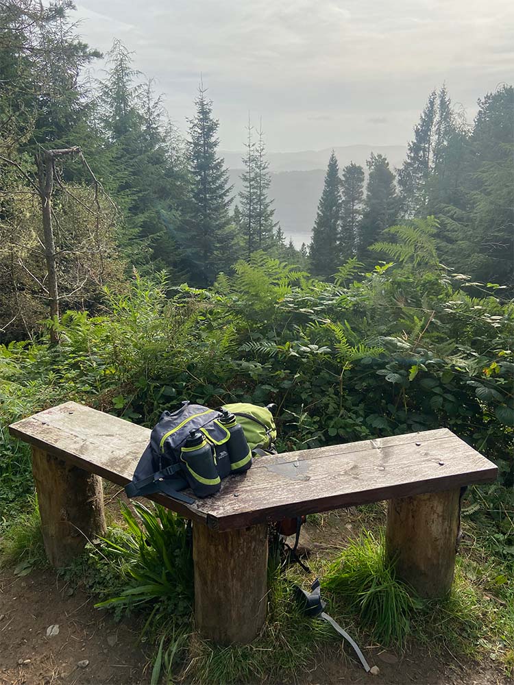
I stopped off at the little café run by the post office in town before heading the long trudge beside the busy main road. I had guessed that this day should only be maybe around 7-9 miles so I was hoping for a short day. It already felt like I’d done 2 or 3 before the track left the road and up again into the forest. This was another steady climb with very little respite. As the track neared the end of the forest path there was a detour to a bench and viewing area that seemed too good an opportunity to miss.
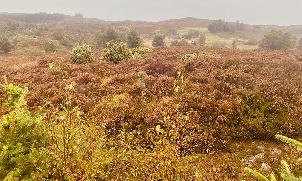
The rain had been light and given the short day I decided to strip off the waterproofs trousers and let my regular clothes dry off a bit. This was probably not one of my best ideas; not long after exiting the forest into open moor I passed the remains of a former ‘Newfie’ camp from WWII (Newfoundlanders who came to Scotland to work in the forest and help the war effort), Then with no trees for shelter the rain started coming down in buckets. The path soon became a river and I hadn’t much option but to just keep going and hope I didn’t end up with pneumonia by lunchtime. Pretty soon I began to pass walkers coming the other way – some of whom I recognised. They were part of an organised tour doing the Great Glen Way. They were all booked into nice comfortable accommodation each night with buses laid on to pick them up and drop them off at the start and end each day. Inexplicably though the tour was set up so they all walked this section in reverse. This used to be the highest point on the whole way so it seemed like cheating to me to not have to climb up. I did find myself muttering ‘bloody day walkers’ under my breath a few times.
The wet and winding road eventually reached the edge of the Abriachan forest. This is all owned and managed by the local community and there are lots of forest walks and bike trails as well as a recreated roundhouse etc. Brightly painted wooden birds are perched on fence posts on the route which was cheering despite the awful weather.
Soon I reached a small road and while my accommodation lay somewhere down to the right, I pressed on to get to the legendary Eco Café that is well documented on the route. Signs for the café appear painted on scraps of wood through the trees for a good mile before you even reach it. The café itself is a charmingly eccentric experience. A scattering of benches sit in mixed woodland and at the end a large wire fence and gate offers a glimpse of a house that seems to be built from odds and ends. There is a bell to ring to attract attention and remarkably a sign that they can take credit cards (impressive when apparently, they don’t have electricity).
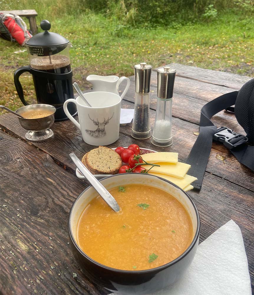
A very happy homely woman with a distinctive Aberdeenshire accent arrived and told me what was available I opted for some hot lentil soup and coffee and sat down. I’ve read some odd reviews of this place on Facebook but the couple who ran the café were incredibly polite and friendly, and I could see that many of the issues that were brought up seem to have been addressed. The logistics of running an establishment like this so far away from amenities is always going to have a cost but considering I was served enough coffee to keep a bus party going there’s not much to complain about (and the soup, served with fresh tomatoes and oatcakes was fantastic).
Suitably refreshed and a little thawed out I headed off to find the camping pod that was home for my final night. Another minor road headed back roughly the way I’d come and then downhill for a mile before reaching ‘Camping Pod Heaven’. Well it wasn’t quite heaven but it was warm and dry and more than enough to help me dry off and get warm after a much longer day than I’d expected.
Day 7: Abriachan to Inverness.
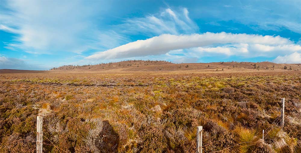
The camping pod was very sparsely equipped, really just a wooden hut with an inflatable mattress. It wasn’t the best of sleeps, but I think I was getting used to the constant change in sleeping arrangements. The weather forecast was set a for a much better day but the morning was overcast and wet. It was also nearly an hour of walking back up a minor road to reach the point that id left the trail the previous day. Another few hours of road walking over exposed moorland, the wind had changed and was coming in over the moor from the north so the temperature had dropped a lot. This really felt like the end of the season and I couldn’t imaging my three-season gear doing well here.
From the high point on the moor I could see down towards the Beauly firth, Inverness was not so far away now. After a while the track went off-road again and I was thankful for something less unforgiving underfoot. This was a pleasant and gentle walk and gradually the clouds began to break up and sun splashed over the glen. Once into the forest again I took the chance to get the wet weather gear off and change into more comfortable attire. This section led along narrow paths and open woodland, eventually turning onto the remains of an old drove road (cattle road) that ran between tumbled down moss-covered dry-stone walls.
The odd clearing offered a tantalising view towards the Cromarty firth, but it was some time before I caught sight of the first buildings on the edge of inverness. The descent from the slopes of Dunain hill was fairly gentle and soon I could see a bit more of the city and for the first time the red sandstone of Inverness castle – the end of my journey! The track led past a small reservoir and it was quite shocking how low the water level was, despite the rain showers I’d experienced the reservoir was practically empty with large boulders on the bottom sticking through what water there was. It had been a similar story on the journey up as the train ran alongside Loch Treig – so much so that the guard on the train remarked he had never seen the water level so low, yet another stark reminder of the damage climate change is doing to our fragile environment.
Very soon the path dropped through more trees and emerged on the edge of a small housing estate. It was an odd experience, limping along with a full backpack past people out washing cars or relaxing in their gardens. I felt very conspicuous and even though Inverness is a very safe city it was disconcerting walking through graffitied underpasses. At last the canal was reached and the towpath led me towards Fort William rather than away from it, not for long though and after crossing a swing bridge I passed a familiar sight; A few years ago, at Christmas we had rented a very quaint cottage on the canal bank. I knew the route took me this way and I had remembered seeing many walkers pass by when I was there, it was one of the points on my journey that id pictured in my head so quite a milestone so to speak. This final leg was incredibly familiar, both from that Christmas trip walking into town and also from the time I had spent living here. My mind was cast back to that time in my early 30s living a single(ish) life in Inverness – my younger self would have skipped along this route in half the time without breaking sweat but I doubt it would have provided the same rewards.
As I drew closer of course I encountered more people going about their daily lives, its an odd experience I remember from walking the West Highland Way and hitting the Fort William High St – after days where everyone you meet has shared your experience and it was almost obligatory to stop and chat about the common journey you feel somewhat deflated and ever so slightly invisible. Tourists were everywhere as I crossed over the Ness Islands – one of the prettiest parts of the city and an area I’ve always been very fond of. By now I was fantasising about touching the marker stone and collapsing onto the grass by the castle. The steep hill up to the castle grounds didn’t seem to be quite so steep as the excitement of reaching the end grew, there was the entrance, there was the stone, there were the tourists reading the info on the plaque – I waved them out of the way and slapped the stone slab in triumph – pulled off my rucksack and planted myself down on the nearby bench….. I’d done it!
Sitting there, lost in my own thoughts a wave of emotion caught me by surprise. This little wander through the highlands had been something I didn’t actually think I’d have been capable of – not carrying my home on my back like a snail. I felt the possibilities open up for me; routes that id never consider attempting at my age were suddenly achievable – if I can do this then what’s next?
But that was for another time. Now I had to fulfil a few final goals of some food – a few ‘end of trail’ beers in my favourite Inverness pub, The Pheonix and the train home. Time to reflect on the journey. All through my trip id been posting my progress on my Facebook account and it was overwhelming as messages of congratulation came in. Many said to me that they had enjoyed following my little adventure as they felt they were walking with me. However, it was their constant presence and words of encouragement that had come with me all the way – I felt immense gratitude to everyone that had given me as much as a ‘like’ along the 78 miles of this journey through this incredible country.